Hip Homeschool Hop ~ 9-21-10 ~ Map Drawing
This week we are starting something new. Over the summer I was asked to review a book called The Core: Teaching Your Child the Foundations of Classical Education. While I did not find the book to be very useful overall, I did find one section that I totally loved.
In Chapter Seven – Geography, Leigh A. Bortins says, “Having a basic map in our heads helps us to form accurate images of international conflicts or relive adventures with historical heroes or sympathize with the plights of man beset by natural disasters. Knowing geography gives structure to real stories. It’s hard to get lost in the snow in the Sahara, though one can freeze to death there. It’s hard to climb the Great Plains, but you do have to scale some elevation to get to them.”
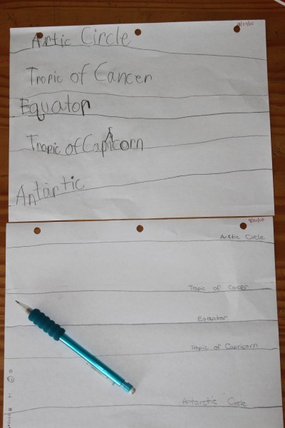
With this premise in mind, Leigh sets out a plan of map drawing that I think it fantastic. It starts with the drawing of the 5 great circles (they are the latitudinal lines of the Arctic, Tropic of Cancer, the Equator, the Tropic of Capricorn and the Antarctic Circle). Then she adds in things like the Prime Meridian & International Date Line, each continent, and then eventually country details and so on. The idea of starting with 5 lines of latitude, then adding in 2 of longitude for reference points is so simple that I should have thought of it! But that is one of the things I loved most, how simple each step is broken down. Now by simple, I don’t necessarily mean quick. After you have added “blobs” as Leigh calls them, for continents, the details of the continents shapes will take a whole lot longer to master.
For now, I am happy to start with lines of latitude, longitude, and relative blobs for the continents. As the kids get better at each thing, we will move along. I will leave you with a photo of what Jayden (my seven year old), and Chloe (my 11 year old) have mastered so far.


September 21, 2010 @ 12:31 pm
Wow! I have never seen a geography lesson began with the lines of latitude. It seems so much simpler to learn the lines and then the continents, it’s almost as if we have been doing it backwards our whole lives! My daughter is only four, but I will have to remember this lesson for her future geography studies. By the way, I found your blog at the Hip Homeschool Hop!
September 21, 2010 @ 12:49 pm
I love looking at their schoolwork! sounds very interesting. 🙂 visiting from the homeschool hop!
September 21, 2010 @ 4:24 pm
I will have to remember that for geography. It just seems like it would be much easier. Stopping by from the Homeschool Hop!
September 22, 2010 @ 8:58 pm
Hey! Visiting from the homeschool hop! That geography sounds interesting. Will have to come back & check it out. That’s one of my weak points.
Blessings!